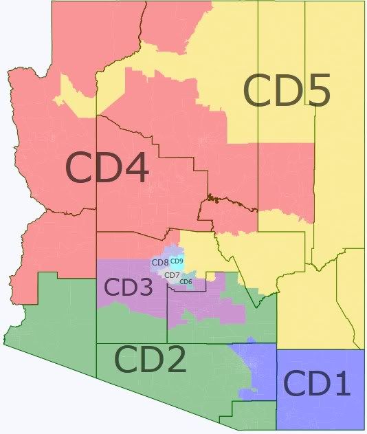
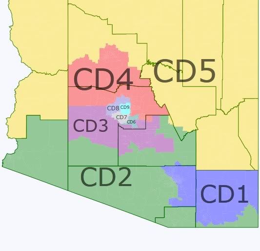
Arizona's redistricting commission just came out with its “grid maps” that are intended as starting points for the actual maps. As the site itself notes, these maps consider only equal population, compactness, and contiguity. They ignore other factors that they are required to consider by state or federal law: VRA compliance, communities of interest, city/county boundaries, and competitiveness. The commission decided to use “option 2”, shown here.
http://www.azredistricting.org/...
Thumbnail descriptions of the “districts”:
1-Pima east of I-19, Cochise, bits of Santa Cruz, most of Graham and Greenlee
2-Pinal minus much of northern exurbs, Pima west of I-19, most of Santa Cruz
3-Yuma, far western (mostly empty) Maricopa and Pima, southern Phoenix exurbs
4-Yavapai, Mohave, Coconino, La Paz, northwest Maricopa exurbs, bits of Gila
5-Navajo, Apache, northeast Maricopa, most of Gila, bits of Pinal, Graham, and Greenlee
6-east valley burbs, mostly Mesa and Chandler
7-south Phoenix, Tempe, Ahwatukee
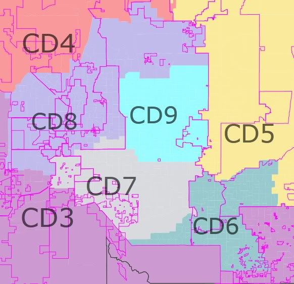
8-northwest burbs including Glendale and Peoria
9-north Phoenix
Here I attempt to make a map that satisfies all of the commission's criteria while sticking as close to the grid map as possible. The most obvious immediate problem is that you can easily make two compact majority-Hispanic districts corresponding roughly to Pastor's and Grijalva's current ones. The grid's AZ2 and AZ7 fall short on that count.
To fix AZ7, I had it vacate Ahwatukee and Tempe which don't have enough Hispanics, and move northwest to take part of Glendale and the remainder of Avondale, leaving AZ6 as the obvious candidate to pick up the vacated areas.
I tried to keep Grijalva's district out of Yuma as on the grid map but could not get it above 46% Hispanic VAP even after snaking along the border to pick up Douglas. I do not think the feds would accept this, so it will have to go back to Yuma and the new AZ3 will have to be something of a west Phoenix exurban district. My AZ2 ended up a lot like Grijalva's current district. With AZ2 and AZ6 both shifting west, AZ3 had to move east to pick up their vacated areas in Pinal and eastern Maricopa and ended up as a pure southern exurban district. The other districts basically followed the map, although I made an effort to keep as many reservations as possible in AZ5.
State map:
Phoenix closeup:
Tucson closeup:
Notes on districts, where M and O refer to McCain's or Obama's margin in 2008 respectively:
AZ1, M2.5: This closely resembles Giffords' current district but becomes slightly more blue as it sheds some of its western fringe. Safe D for Giffords, tilt R for anyone else.
AZ2, O9.7: Compared to Grijalva's current (overpopulated) district, this vacates La Paz and the Phoenix area and picks up heavily Hispanic parts of eastern Pinal and the Hayden-Winkelman area of Gila. It's 52% Hispanic VAP which is iffy for VRA purposes, but 58% Hispanic overall so its VAP will only increase over time. Likely D but it would probably take someone more moderate (or at least less outspoken) than Grijalva to win it consistently.
AZ3, M22.6: This district has Gilbert, Queen Creek, southwestern Maricopa exurbs, and most of exurban Pinal except for Apache Junction. It was mostly empty 10 years ago so its community of interest would be “foreclosure-ridden Phoenix exurbs”. Safe R, but has no incumbent.
AZ4, M25.0: Looks a lot like it did on the concept map but had to give up parts of Coconino to keep the Navajo rez together, and took the non-rez parts of Navajo county to hit its population target. Gosar would be the incumbent here although it probably has more population from Franks' overpopulated district. Safe R.
AZ5, M11.1: This disjointed district looks much the way it did on the concept map but picks up more rez territory, and of course sticks the Hopi rez in with the Navajo rez from which it has historically been separated. If the commission wants to keep them separate as usual, AZ5 could just trade AZ4 some Gila or Coconino county precincts for the Hopi rez. As is, AZ5 is Scottsdale, Fountain Hills, east Mesa, Apache Junction, a bunch of Indian reservations, and a few non-rez rural areas. The district's overall PVI is similar to the current AZ1 which has been competitive, but unlike AZ1 it lumps together urban and rural areas with nothing in common. Moreover, everything in this district is either deep red or deep blue with the exceptions of south Scottsdale and Greenlee county. Schweikert would be the incumbent here. Lean R to likely R.
AZ6, M4.9. This is a compact, coherent district of older suburbs with Tempe, Ahwatukee, Chandler, and west Mesa. It has a mix of blue, red, and purple areas and is highly competitive. It's just 60% white overall, and has the most Asians and the second most blacks of any AZ district. No incumbent. Matt Salmon lives here but is probably too conservative to win it in a normal year. Harry Mitchell would be a good fit here if he's up for a return to DC. Lean R for now but seems likely to trend blue as most older suburbs do.
AZ7, O30.9. This is Pastor's current district minus some of its northern end and plus some areas to the west. 59.5% Hispanic VAP. Safe D.
AZ8, M20.8. Most of the older parts of Franks' current district, based on Glendale, Peoria, and Sun City. Safe R.
AZ9, M6.5. Mostly Quayle's current north Phoenix district, but swapping its northern end for part of Pastor's district makes it much more competitive. Like AZ6, this is effectively an inner-ring suburban district that is likely to trend blue over time. Quayle underperformed in 2010 in a much more red version of this district and would be too far right to hold it under these lines even if he had any appeal. Lean R (provided the R is someone with at least minimal political skills) for now.
Overall, this map would produce three competitive districts and two borderline competitive districts, and would likely be anywhere from 5D-4R to 7R-2D in a normal year.
Here is an alternative map that has districts 4 and 5 swap some areas so that 4 ends up a mostly urban district and 5 is a northern rural district entirely outside Maricopa county. This would be less faithful to the base map but I believe it's more consistent with the commission's mandate to preserve communities of interest where possible. The partisan breakdown is almost exactly the same despite the radically different geography: 4 is blood-red and 5 red but somewhat competitive. In the short run, the alternative would probably be better for Dems because it would give Ann Kirkpatrick somewhere to run. This map also gets Grijalva's AZ2 up to 54% Hispanic VAP by snaking along the border to Douglas in exchange for a few precincts on the west side of I-10. This moves AZ2's rating to O11.7 (roughly D+6) and AZ1's to M3.4 which is still more purple than Giffords' current district. Of course this proposed AZ2 would be hideous, but you can still get from the Tucson segment to the Douglas segment without leaving the district if you roll down the Montezuma Canyon Road.
Thoughts?
