This diary will include the maps finding the limits for the states that have actually only Democrats in their delegations to the US House. Then today's maps would not give gains to the Democratic party, but can help to avoid some risks and some unnecessary competitive districts. I drawed some of these maps time ago, and now I think can be published together.
The diary is part of a series of maps that finds the limits for a Democratic Gerrymander for every state. Not only the Republicans can do it in the states where they control the procedure, also the Democratic party can do something on this front to avoid a Republican biass in the overall map of the US House.
I begin drawing the most favourable states just because the Democratic Party has the power, and some positive changes can be done in the maps and even in the procedure to draw the maps.
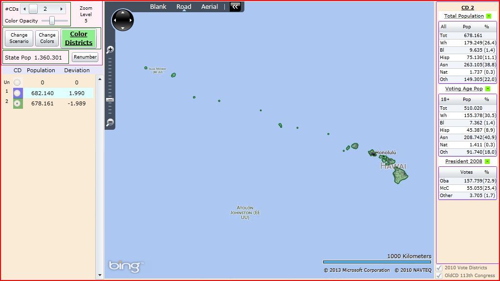
HAWAII
The goal for Hawaii is to find two districts as ballanced as possible.
HI-01:
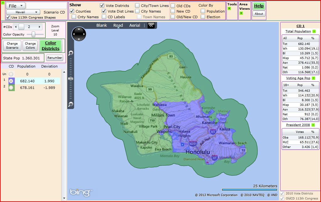
HI-02:
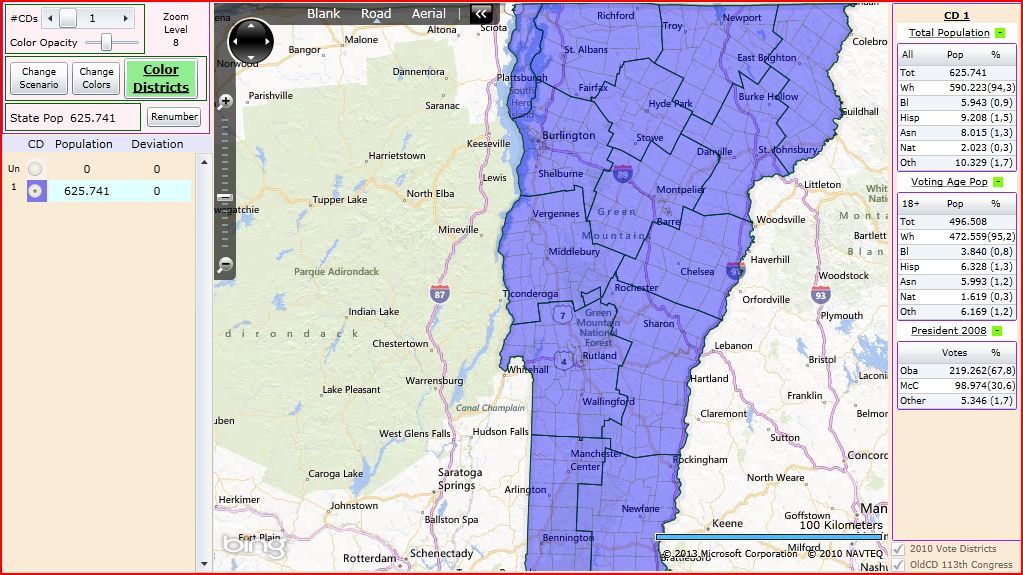
VERMONT
Obvious map but I want to include all the states.
VT-AL:
RHODE ISLAND
Still I drawed not the map, but when the electoral data get included in the VRA, I will edit this diary to include maps for this state too. Despite the state can lose a district in the following apportionment at the end of the decade, I will draw a two districts map.
RI-01:
RI-02:
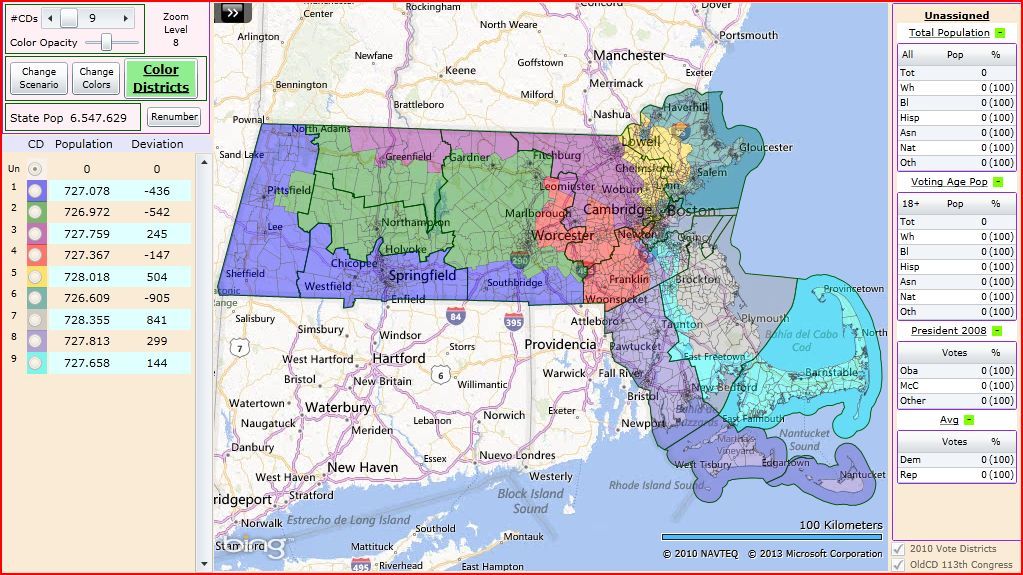
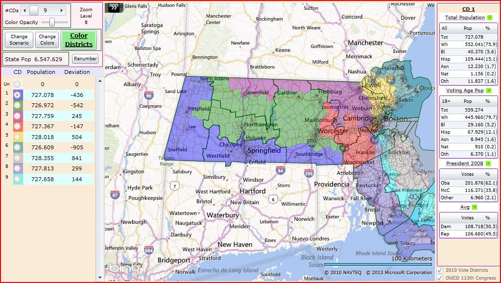
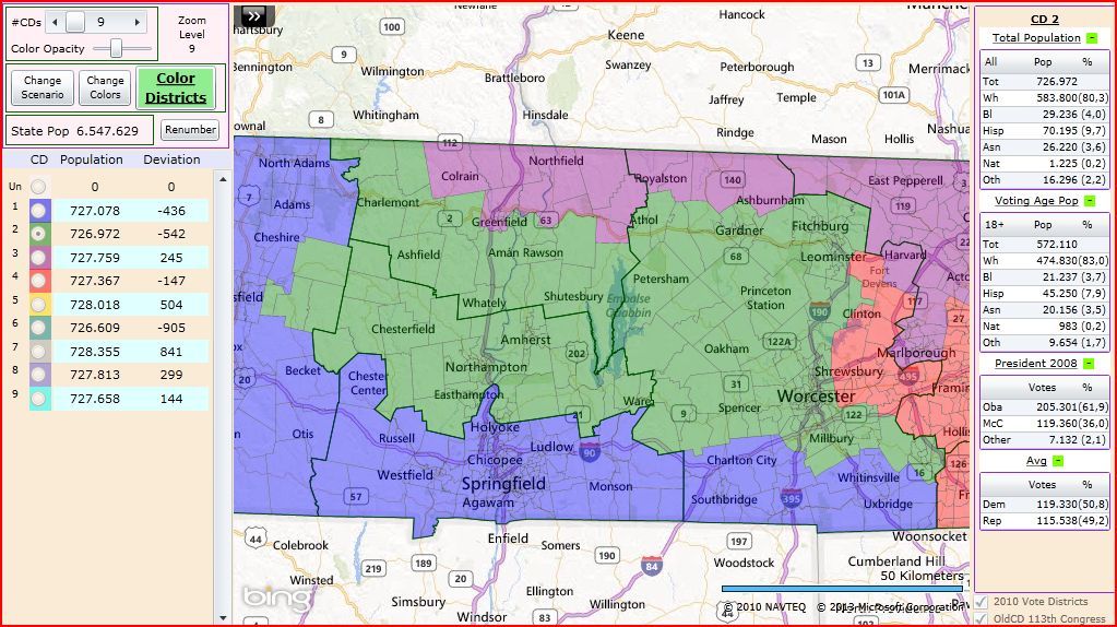
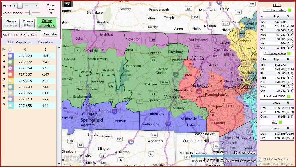
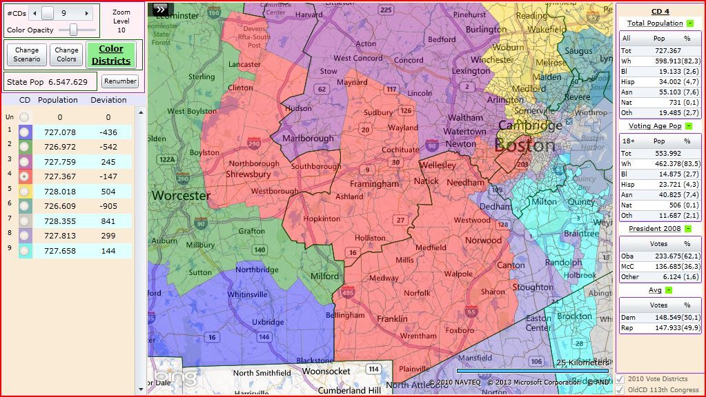
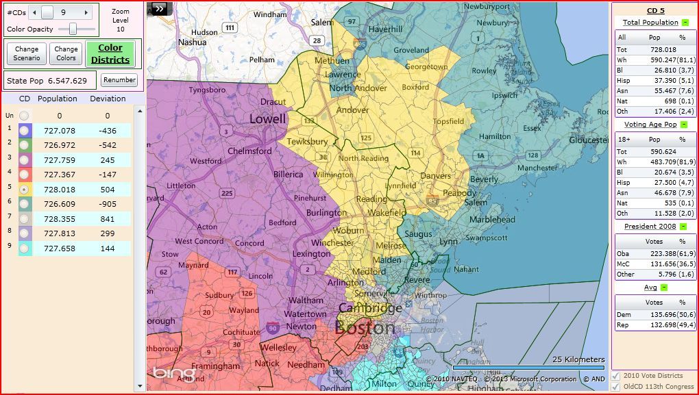
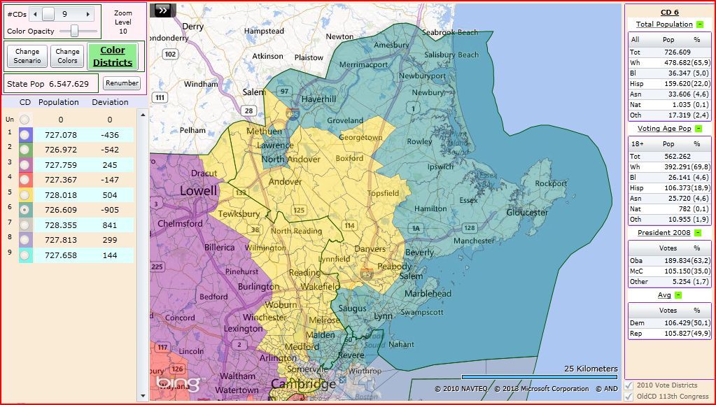
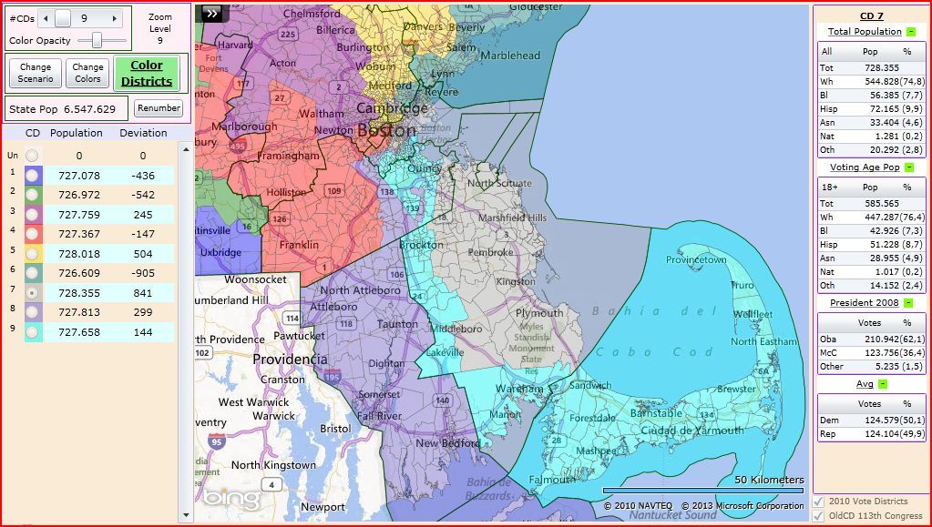
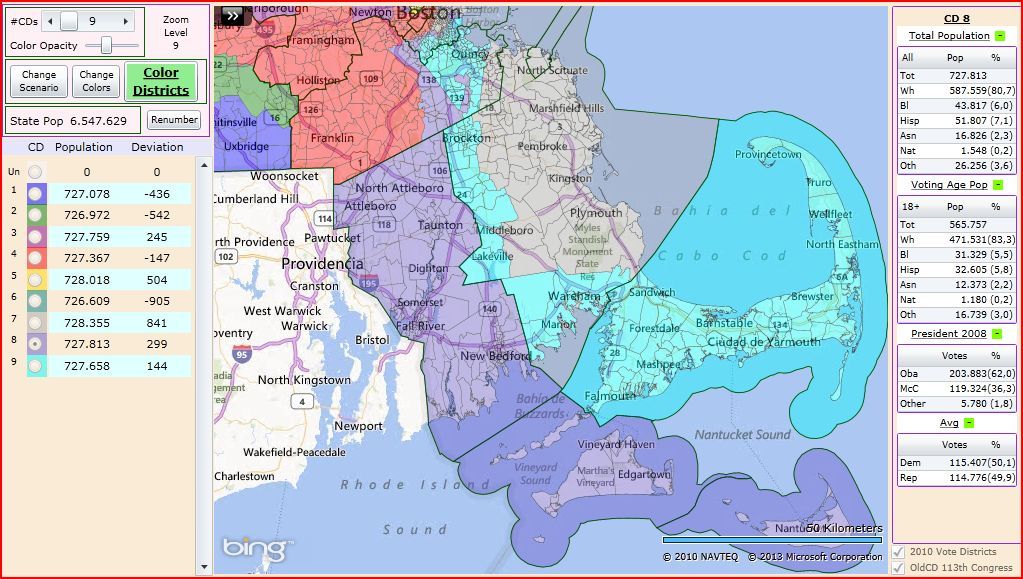
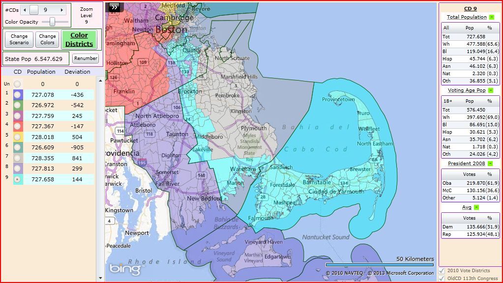
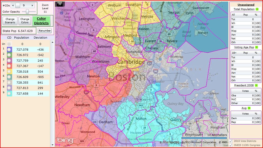
MASSACHUSETTS
The maps for Massachusetts find safe districts for the current incumbents and find to avoid troubles for them. The biggest trouble for it is the place of the home of some of them in the Boston area, but still a so clear map can be done, like you can see.
Overall map:
MA-01:
MA-02:
MA-03:
MA-04:
MA-05:
MA-06:
MA-07:
MA-08:
MA-09:
Boston area:
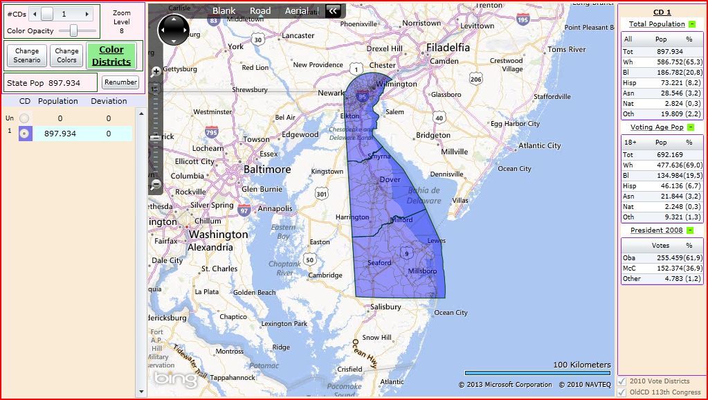
DELAWARE
DE-AL:
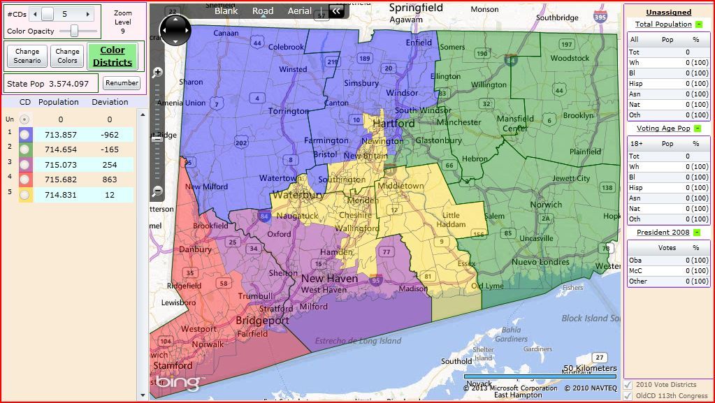
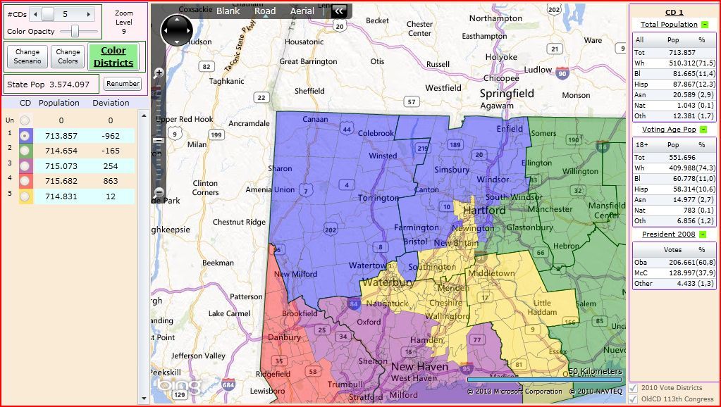
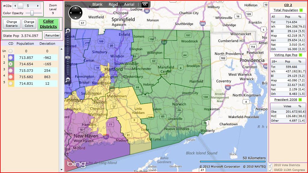
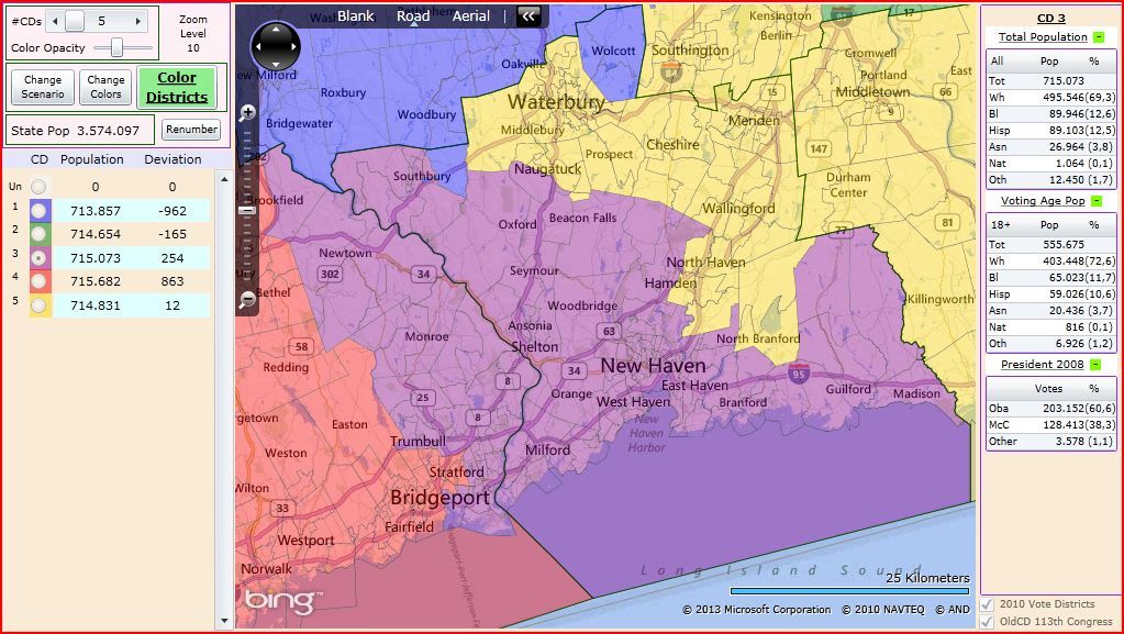
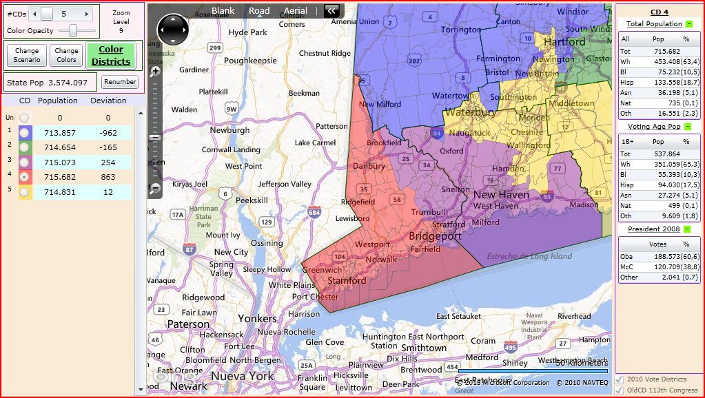
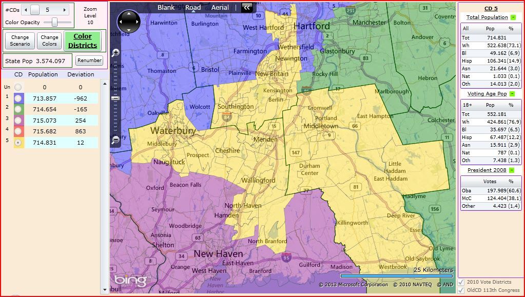
CONNECTICUT
The goal is again the same. To draw easier, nice and clean maps for the Democratic party and incumbents in this state.
Overall map:
CT-01:
CT-02:
CT-03:
CT-04:
CT-05:
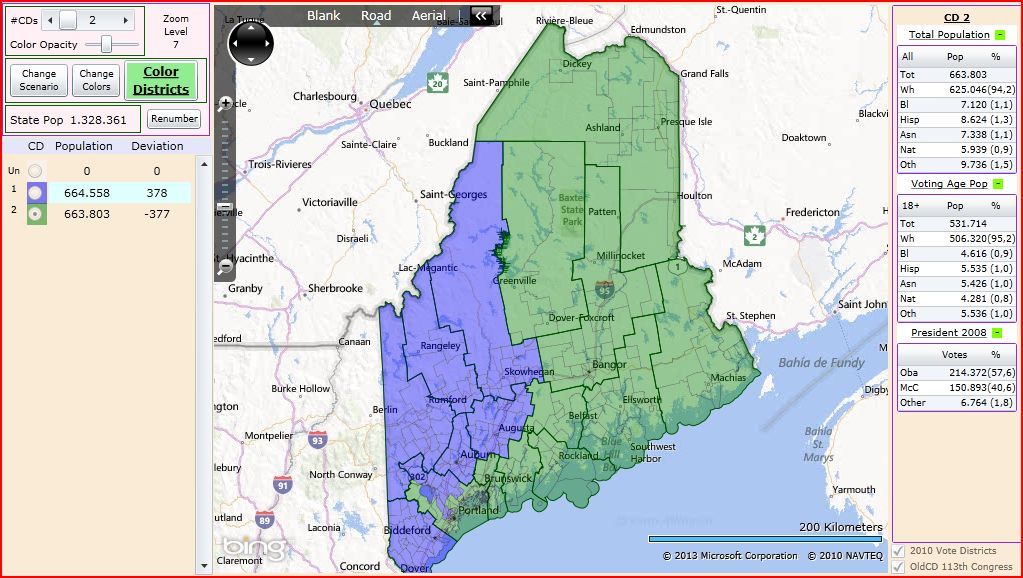
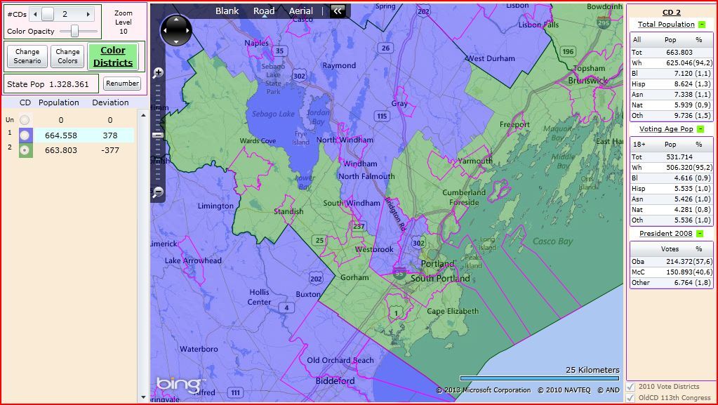
MAINE
For Maine also the goal is to try to avoid troubles in the races for the US House. The maps find two districts as safe as possible. In this case the districts would be safe enough too.
ME-01:
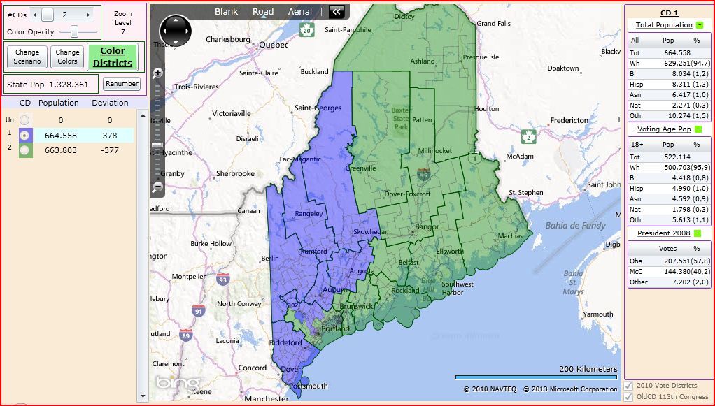
ME-02:
Portland area:
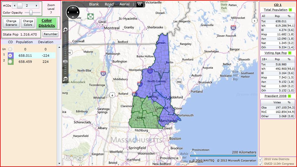
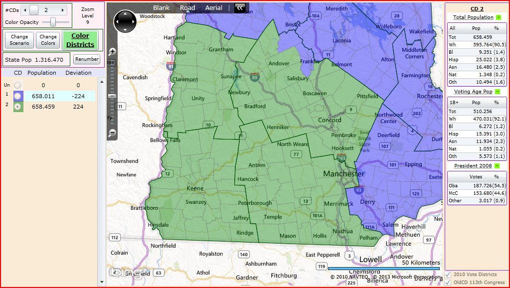
NEW HAMPSHIRE
This time the concept for a Democratic Gerrymander of the state is different. This time I find two swing districts in D+low terretory in order to keep the two seats in Democratic hands, and to take profit of the Democratic trend of the state. Now the result is a D+2 and a D+1 house seats that can become easier still in some years.
NH-01:
NH-02:
FINDING THE LIMITS OF A DEMOCRATIC MAP FOR THE US HOUSE
01.- Hawaii 2D-0SD-0SR-0R map
02.- Vermont 1D-0SD-0SR-0R map
03.- Rhode Island 2D-0SD-0SR-0R map
04.- New York 27D-0SD-0SR-0 map (28-0 then still)
05.- Maryland 8D-0SD-0SR-0R map
06.- Massachusetts 9D-0SD-0SR-0R map
07.- California 53D-0SD-0SR-0R map
08.- Delaware 1D-0SD-0SR-0R map
09.- Illinois 18D-0SD-0SR-0R map
10.- Connecticut 5D-0SD-0SR-0R map
11.- New Jersey 10D-0SD-0SR-2R map
12.- Maine 2D-0SD-0SR-0R map
13.- Washington
14.- Oregon
15.- New Mexico
16.- Michigan
17.- Minnesota
18.- Wisconsin
19.- Nevada
20.- New Hampshire 0D-2SD-0SR-0R map
21.- Iowa
22.- Pennsylvania
23.- Colorado
...
The maps for these 13 states would mean 138 safe seats for the Democratic party and 2 swing seats with a Democratic lean and a Democratic incumbent of a total of 142 seats. It gives a potential improvement of 32 US House seats (all them only from 5 of the 13 states).
I have also done the maps for WA, NM and NV. If I can, I will publish the map finding the limits for Washington tomorrow.
